Glenbeigh · Kerry · Long ago
History in old Photographs.
Glenbeigh and the places around it, from Killorglin and Killarney to Kenmare, the Skellig coast, Dingle and Tralee, between about 1880 and the last train to Valentia in 1960, from the collections of the National Library of Ireland.
Glenbeigh and the Valentia Line
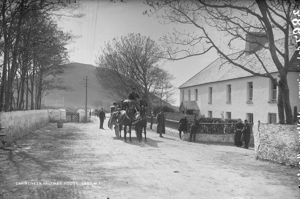
Said to have been a hotel as early as 1840, and mentioned in a guide to Killarney in 1858. The Lawrence studio marked the glass plate “Cahirciveen”; it is Glenbeigh.
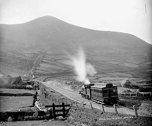
Steam on the railway between Glenbeigh and Kells, cut into the side of Drung Hill above Dingle Bay. The line from Farranfore through Killorglin and Glenbeigh to Valentia ran until 1960; its track bed is now the South Kerry Greenway.
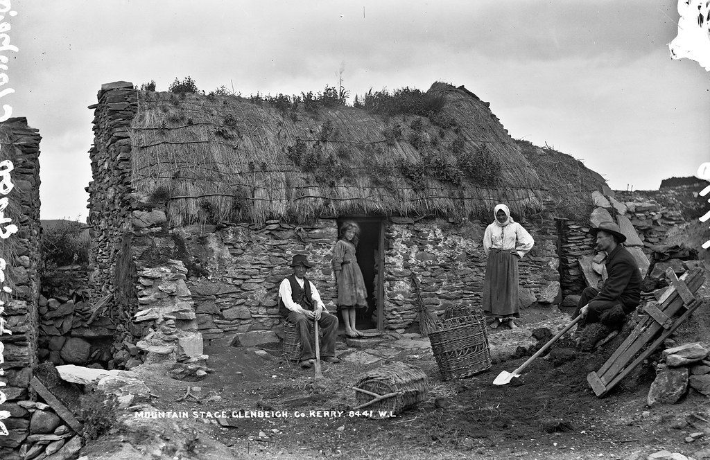
A family outside their cabin near Mountain Stage, west of Glenbeigh. Photographs like this one record how hard life was for many families in rural Kerry at the time.
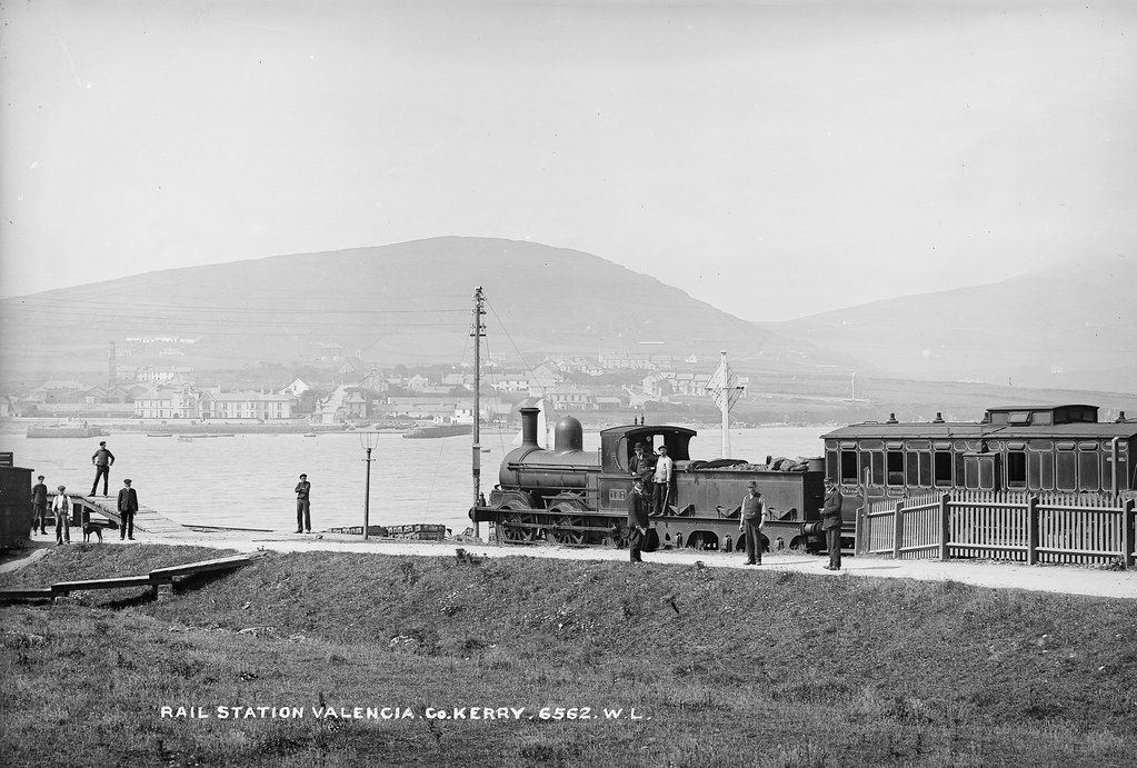
Locomotive 107 at Valentia Harbour station, the western end of the line through Glenbeigh.
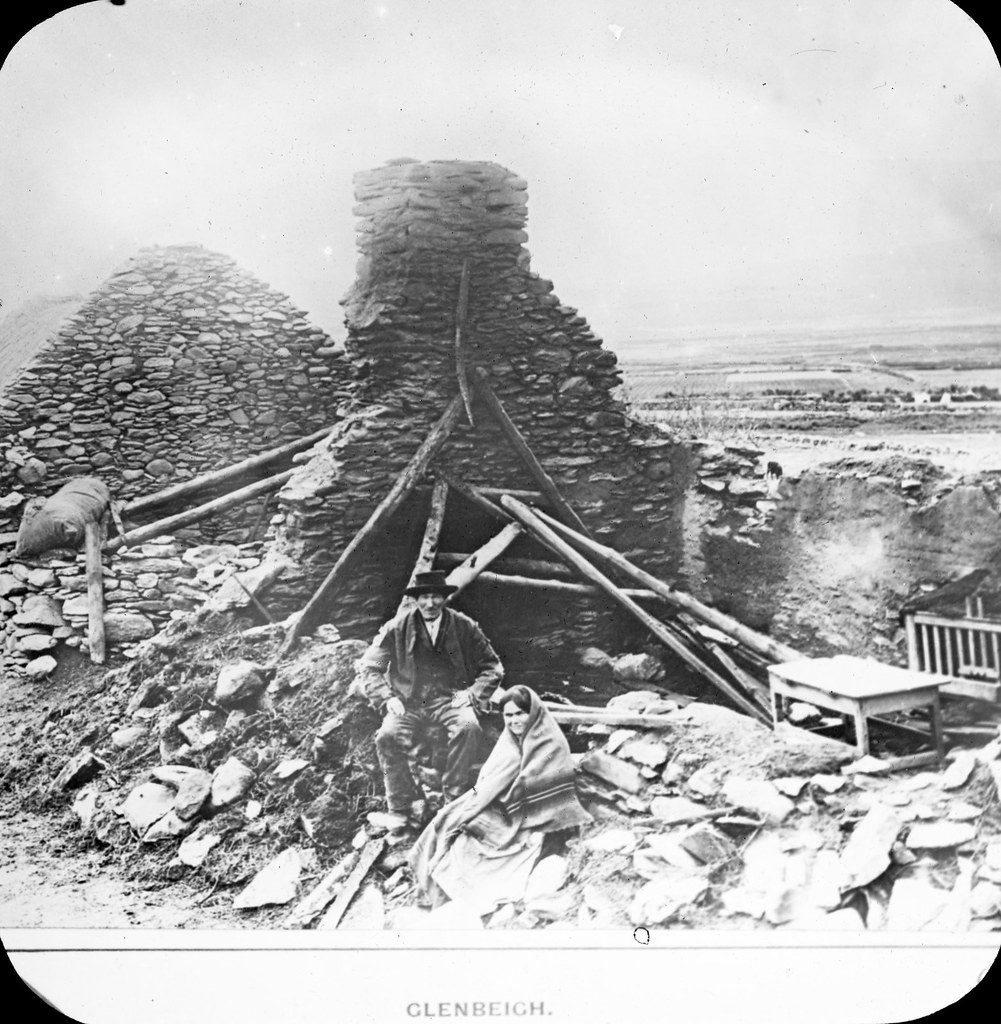
A cottage at Glenbeigh reduced to a pile of stones, photographed in the years after the Glenbeigh evictions of 1887. The story of this particular house is not recorded.
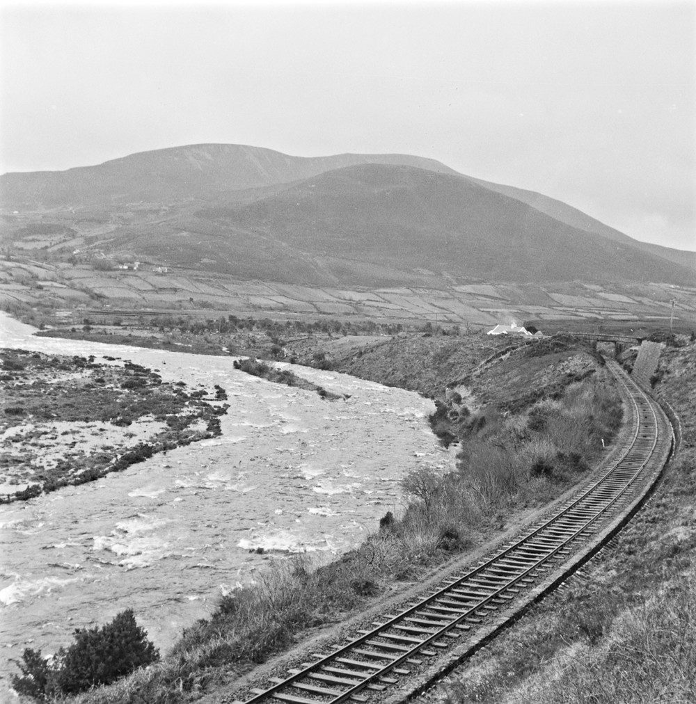
The Caragh River hurrying along beside the Valentia line, photographed a week before the railway closed on 1 February 1960.
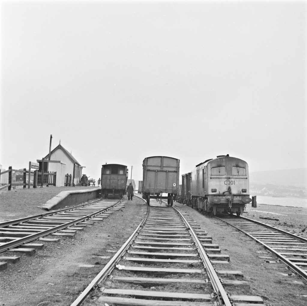
Trains at Valentia Harbour station on the line’s last day, Saturday 30 January 1960, in the photographer’s own note.
Killorglin and Glencar
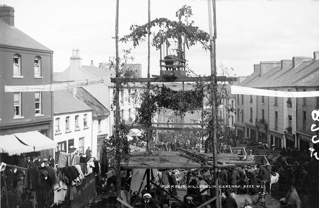
Puck Fair in full flight, with King Puck installed on his “throne” above the crowd. The fair is still held every August.
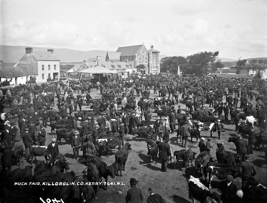
Puck Fair as a working fair: Killorglin full of cattle and dealers.
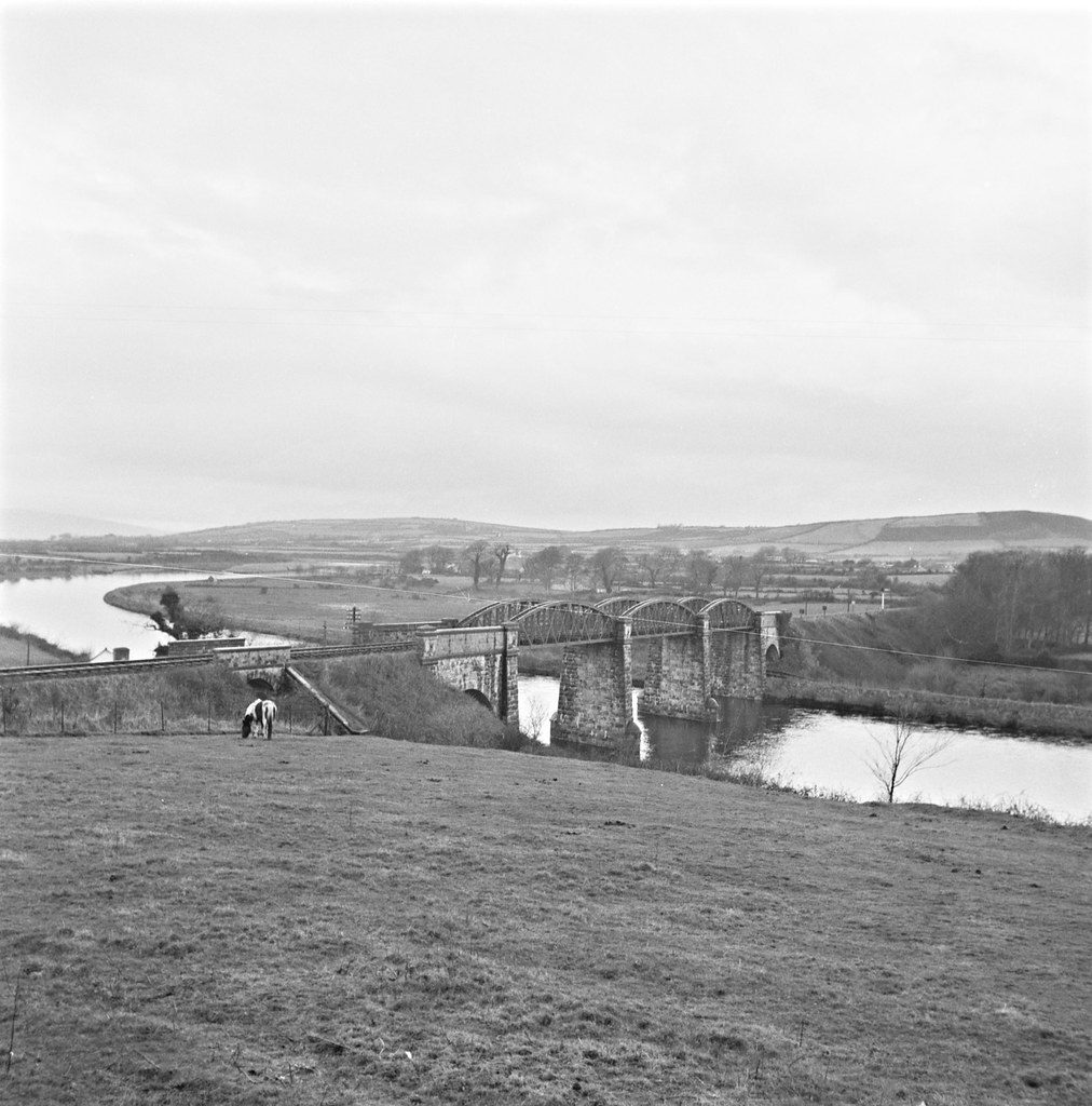
The viaduct over the River Laune that carried the line from Farranfore to Valentia Harbour, days before the railway closed in 1960.
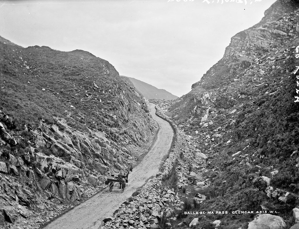
The narrow road through the Ballaghbeama Gap, with a car from the nearby Glencar Hotel.
Killarney and the Lakes
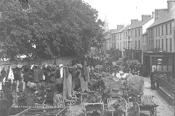
Carts, stalls and dealers on a market day in the town.
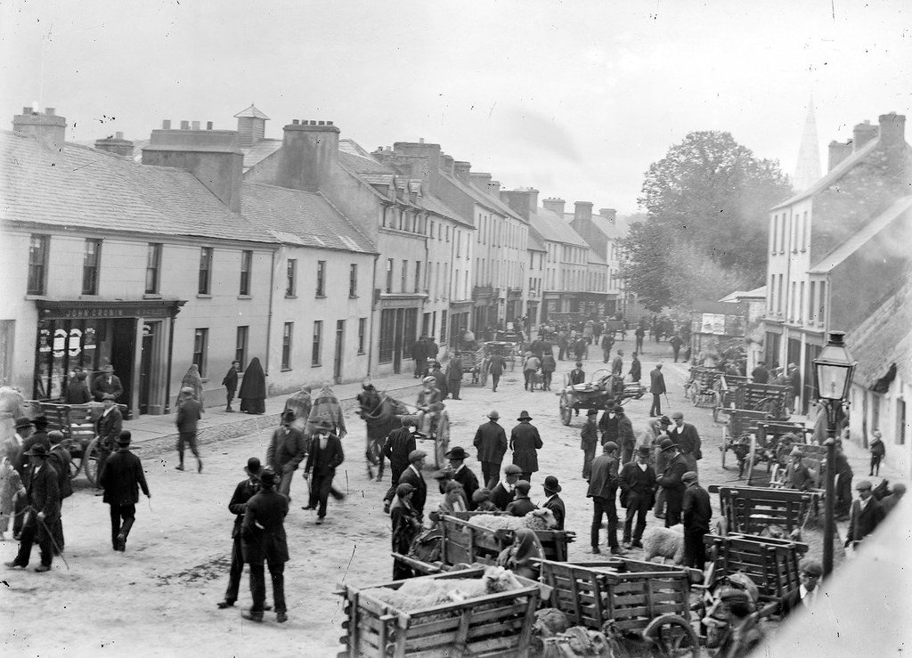
A busy market day on College Street, Killarney.
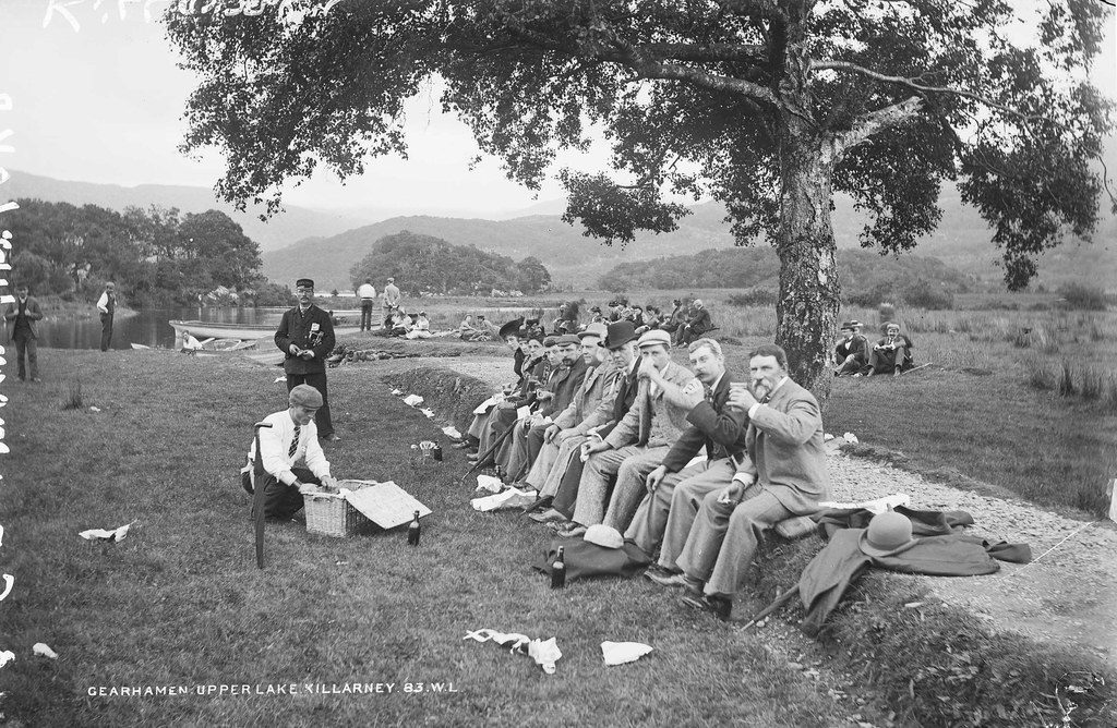
Tourists at lunch where the Gearhameen River flows into the Upper Lake, watched over by a guide from Gaze’s Tours.
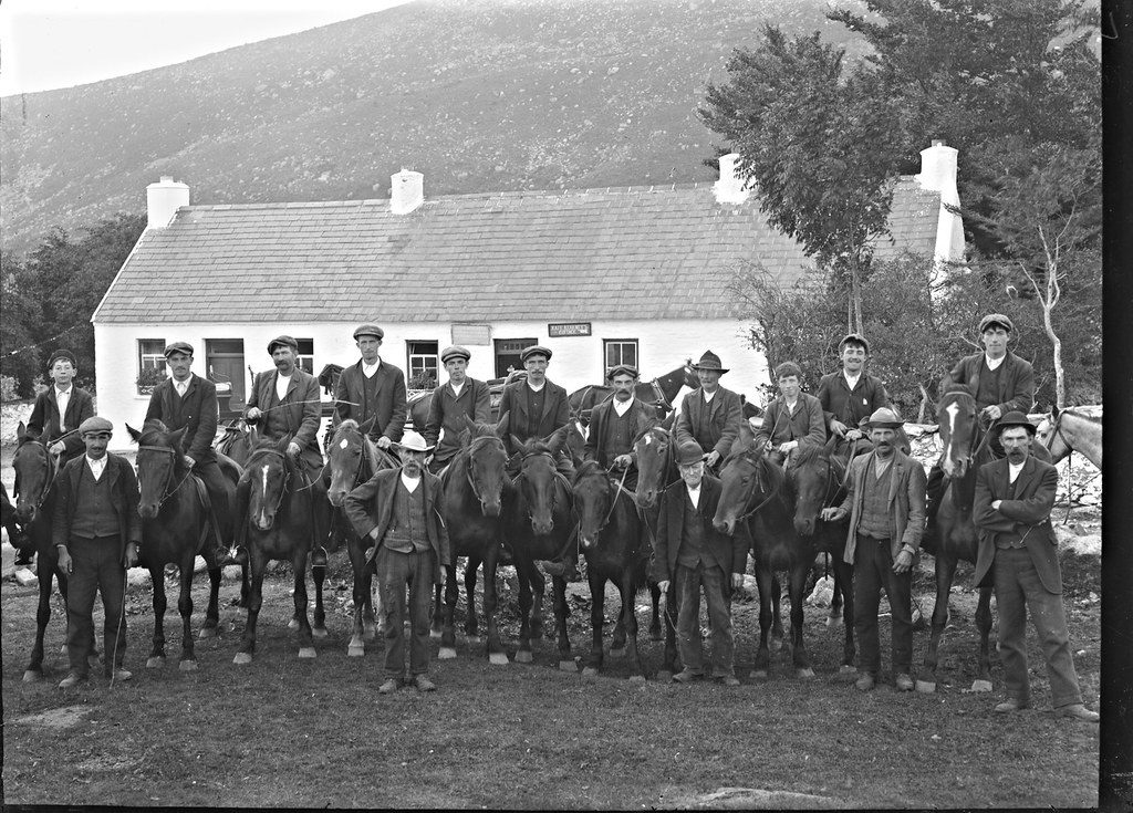
Men on horseback outside Kate Kearney’s Cottage at the entrance to the Gap of Dunloe, perhaps waiting as guides for the day’s visitors.
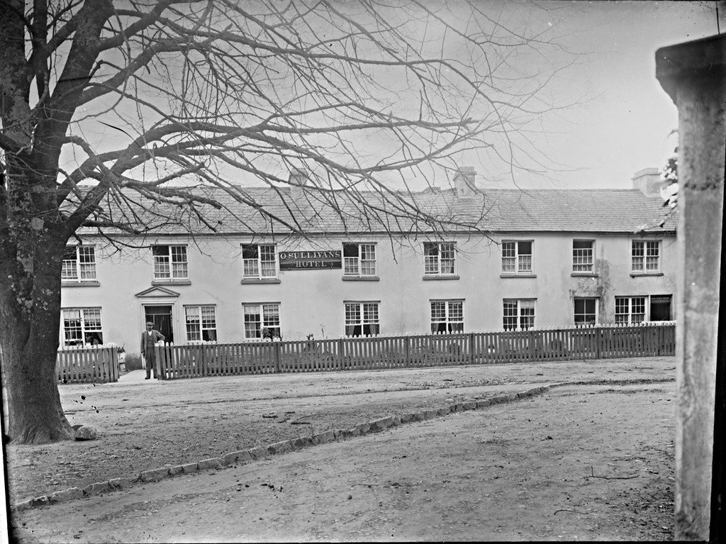
One of the town’s hotels in the early days of tourism to the lakes.
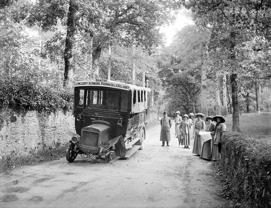
An early motor bus and its passengers on the Kenmare Road out of Killarney.
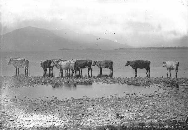
Lough Leane, the Lower Lake of Killarney.
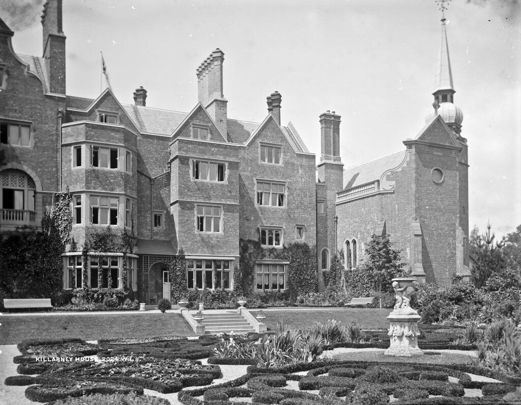
Killarney House, as the Lawrence studio titled it, on the Earls of Kenmare’s estate beside the town.
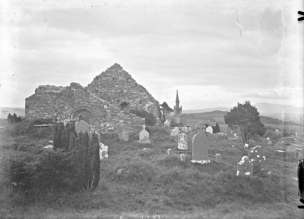
The ruined church on the hill at Aghadoe, above the lakes.
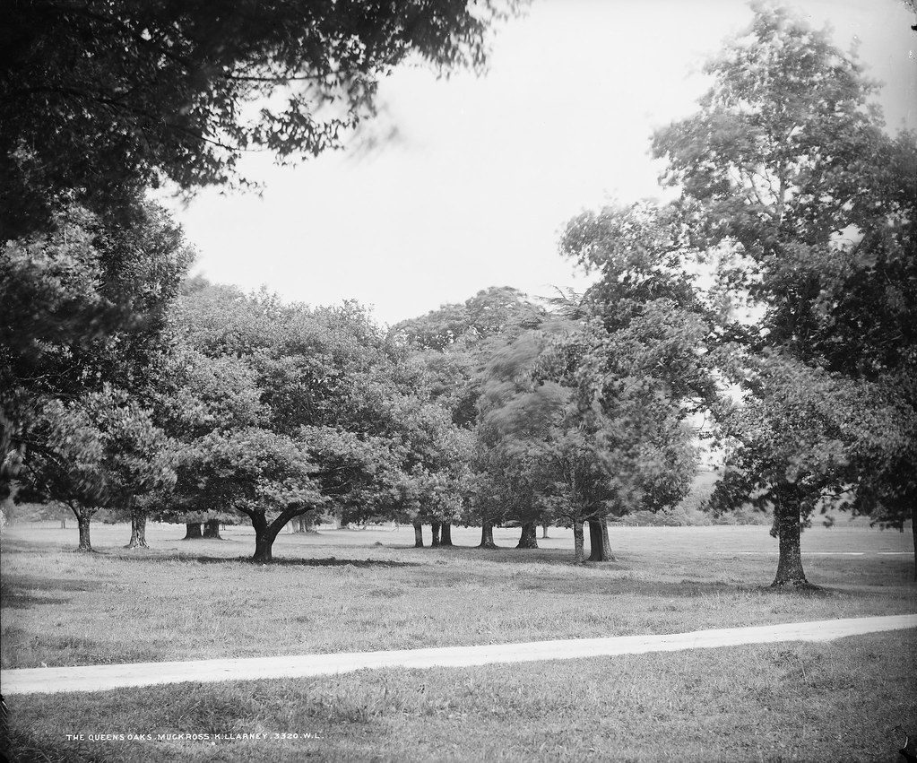
Old oaks in the parkland of Muckross, titled “The Queens Oaks” on the glass plate.
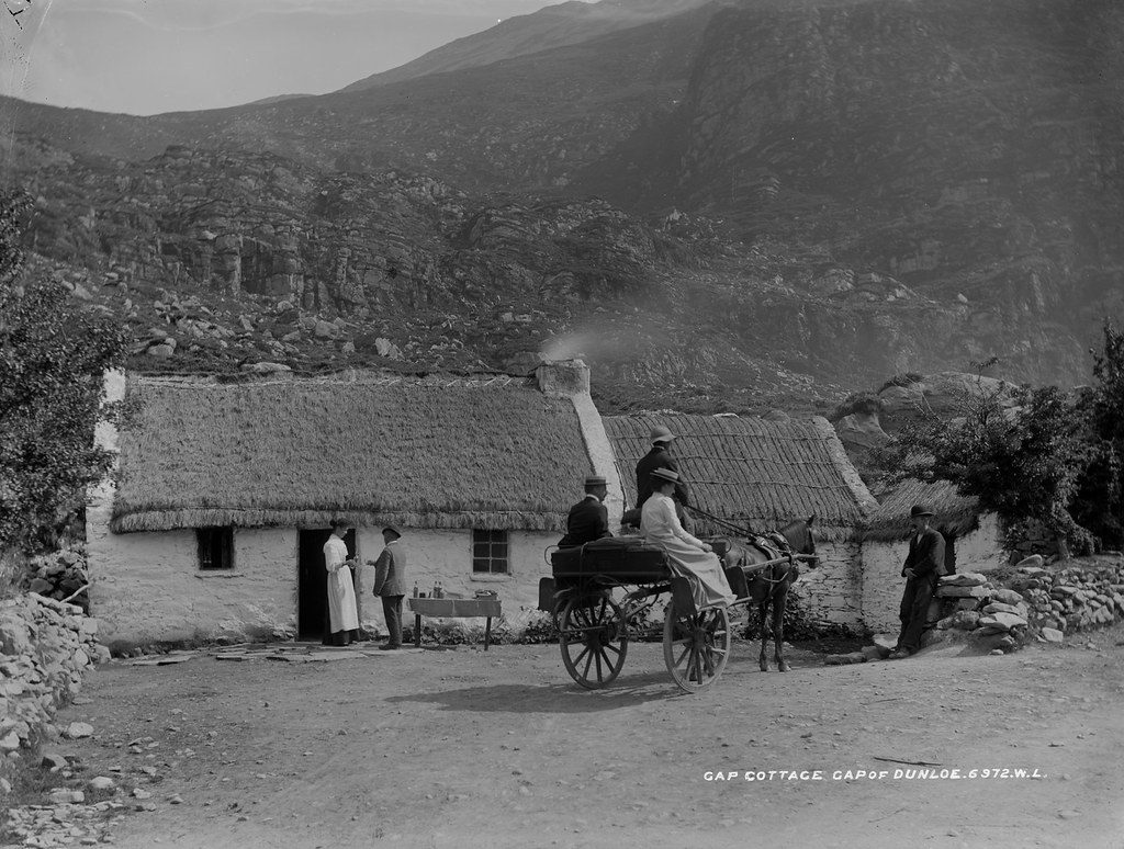
A cottage in the Gap of Dunloe, one of the Moriarty households that served the visitors riding through the Gap.
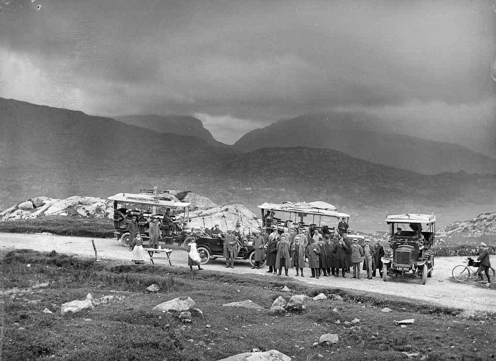
Tour cars stopped at Moll’s Gap under heavy clouds: by the signpost, 15 miles back to Sneem and 14 on to Killarney.
Kenmare and Sneem
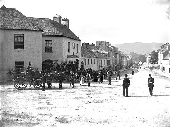
Main Street, Kenmare, with a cyclists’ touring club sign on one of the buildings.
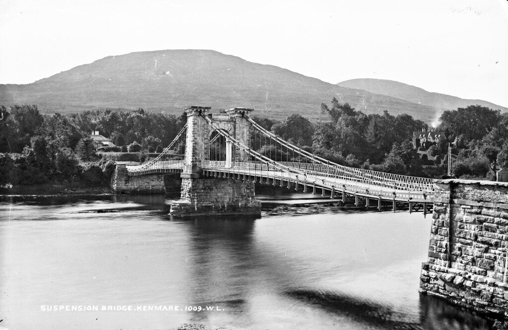
The old suspension bridge across the Kenmare River.
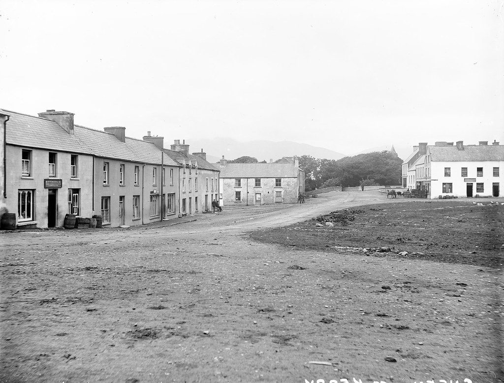
The village of Sneem on the Ring of Kerry.
Cahersiveen, Valentia and the Skellig Coast
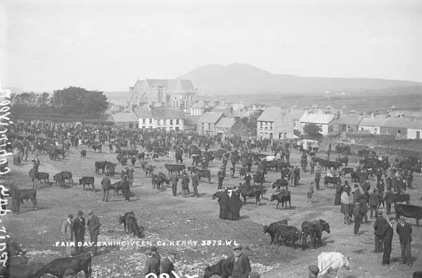
Cattle, horses and dealers fill the fair field on a fair day.
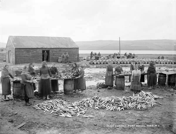
Women gutting and salting fish beside the barrels on the quay at Portmagee.
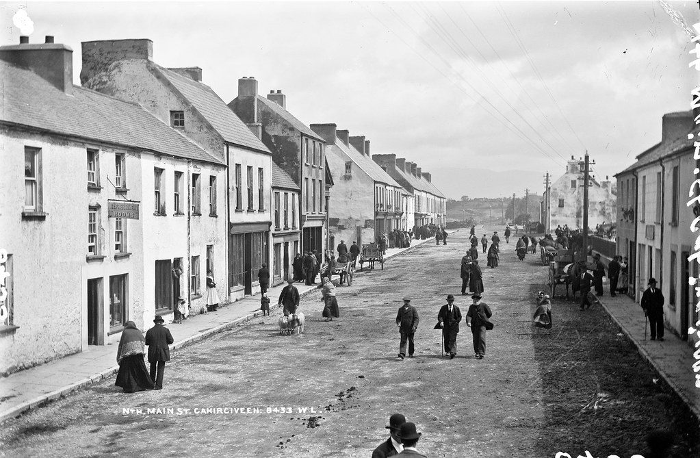
A busy day on Main Street; most of these buildings still stand today.
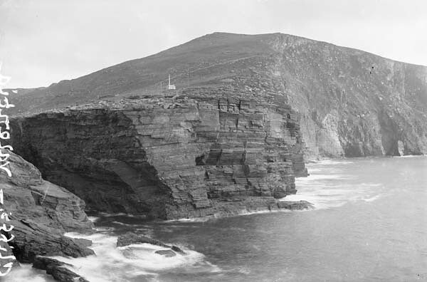
The cliffs of Valentia Island above the Atlantic.
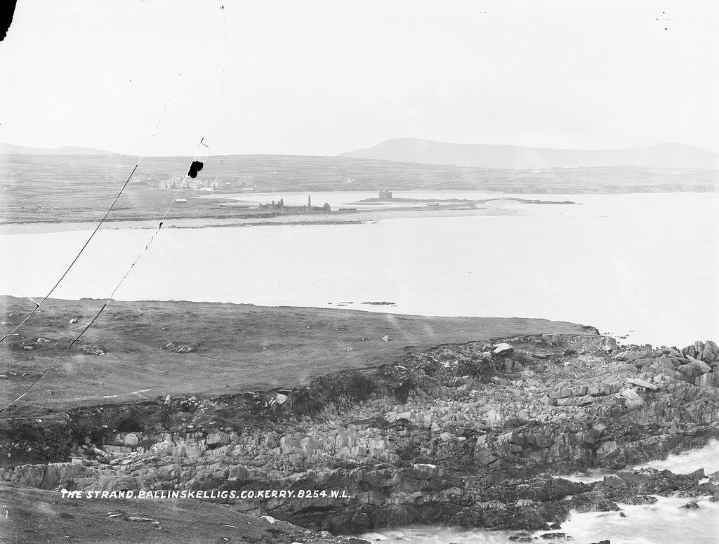
The long strand at Ballinskelligs Bay.
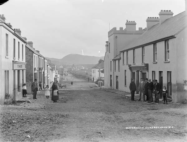
Waterville, between Lough Currane and Ballinskelligs Bay.
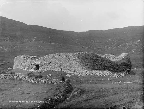
The great drystone ring fort of Staigue, above Castlecove.
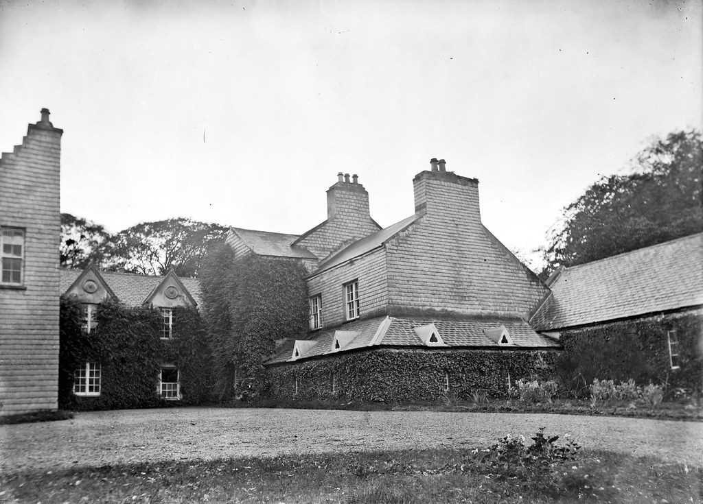
The home of Daniel O’Connell, “the Liberator”, at Derrynane.
The Dingle Peninsula
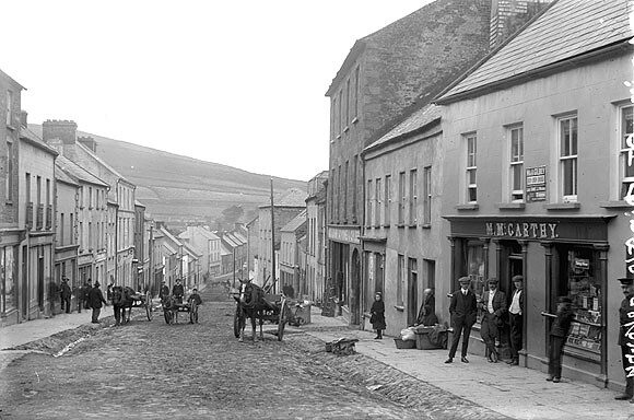
Main Street, Dingle, climbing up from the harbour.
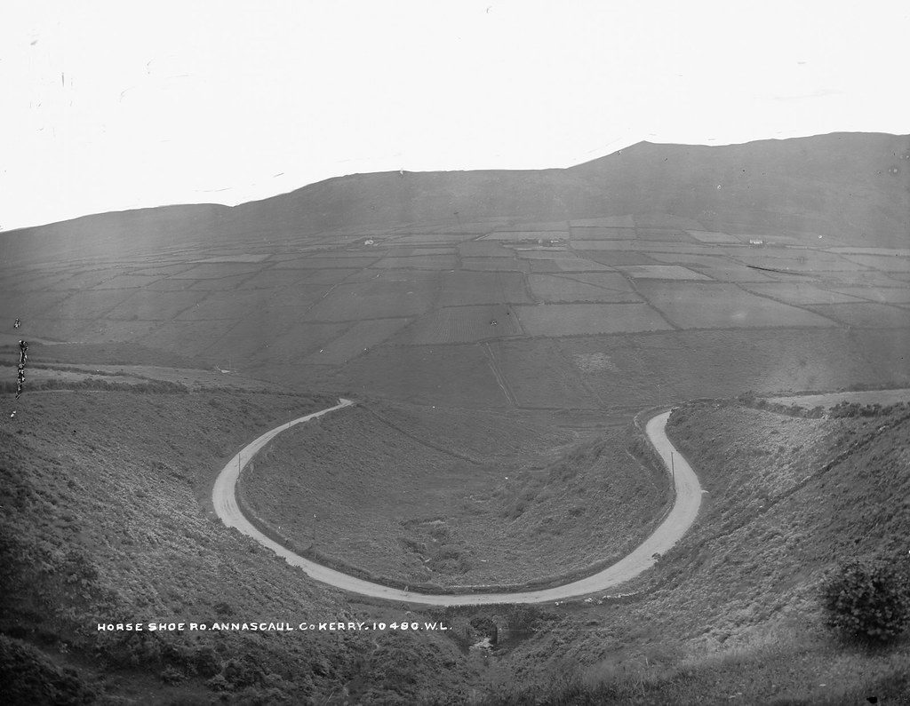
A road curving round a horseshoe bend across a valley near Annascaul, Tom Crean’s home town.
Tralee and North Kerry
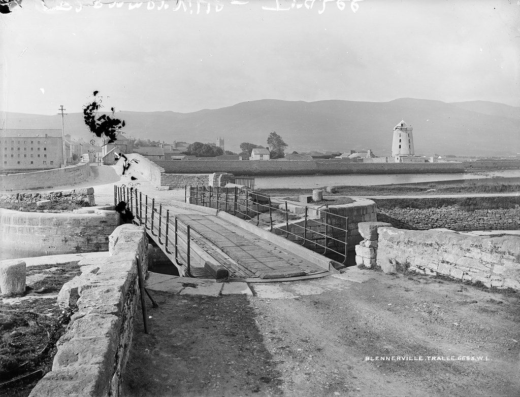
Blennerville on Tralee Bay, home of the windmill.
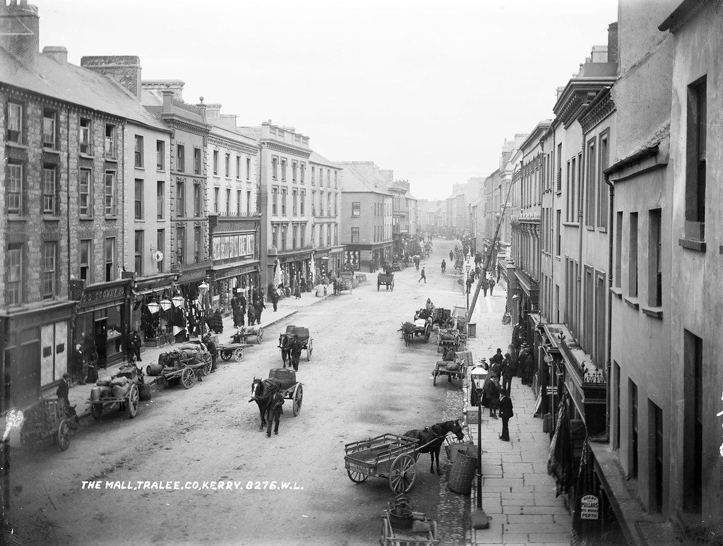
The Mall in Tralee, Kerry’s county town.
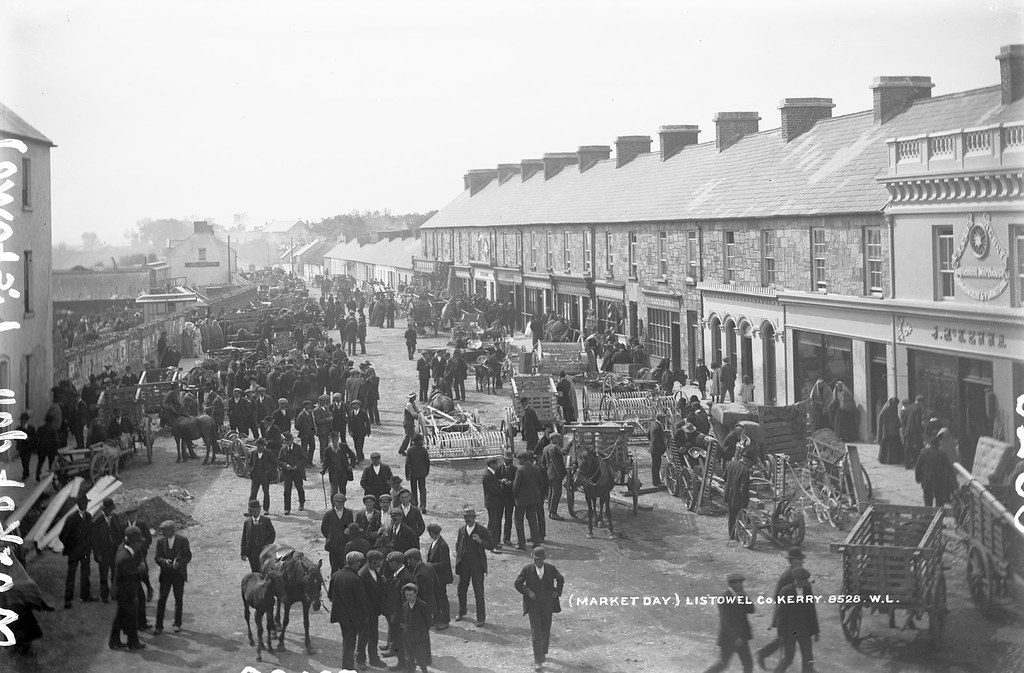
A busy market day in Listowel, with farm machinery on show.
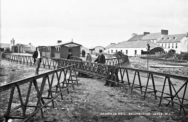
The unusual single-rail monorail that ran from Listowel to Ballybunion from 1888.